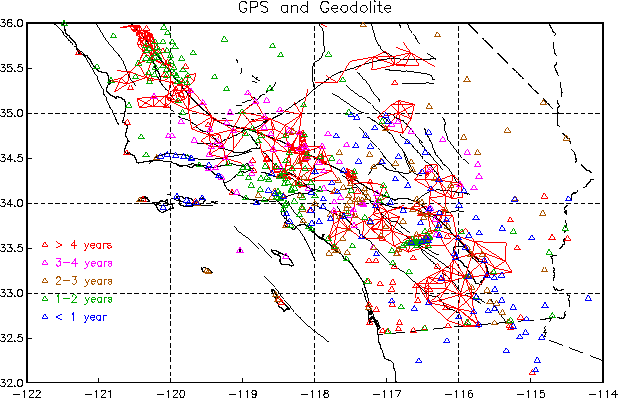
This map shows points at which GPS measurements have been made
(including many not yet in the SCEC archive), color-coded by
the time since the last measurement.
Also shown (with red lines) are the Geodolite distance measurements made
through the 1970's and 1980's by
the Crustal Strain Group at
the U.S. Geological Survey in Menlo Park.
Note that this map (and the submaps for each region bounded by the dashed lines [click anywhere in the rectangle]) has been based on a wide range of sources, not all guaranteed to be correct; updates will be made as new information becomes available (current map date: November, 1995). The submaps give 4-character ID's for the stations; to make these more readable, only one symbol (and ID) is used when there are multiple stations within 250 m of one another.
 DATA CENTER HOME PAGE